
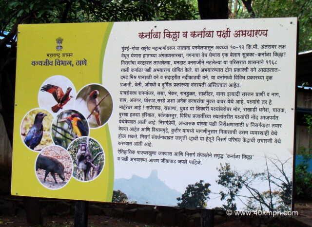
Just 10-12 km from Panvel, while traveling on the Mumbai-Goa National Highway, like a thumb in the distance attracting attention, a clear peak – Karnala Fort that captures the sky! In the year 1968, the government declared the Karnala Bird…

Just 10-12 km from Panvel, while traveling on the Mumbai-Goa National Highway, like a thumb in the distance attracting attention, a clear peak – Karnala Fort that captures the sky! In the year 1968, the government declared the Karnala Bird…
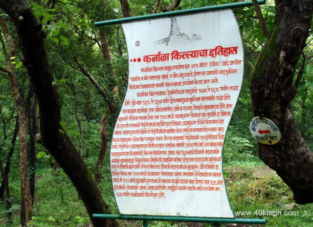
Karnala Fort is situated at a height of 445 meters above sea level. It was used to keep a watch on the trade routes passing through old Panvel and Bhor Ghats, to Mumbai and Chaul ports. This fort was ruled…
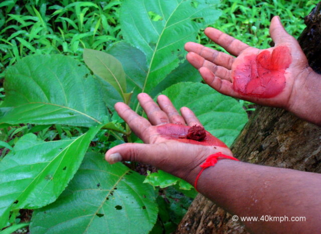
The tour guide enhanced our knowledge by rubbing Teak Tree Leaves, commonly known as Sag (साग) in the Marathi language. He said the Teak Tree Leaves are used for making dyes.
At 8:20 am, we were at Bandra, and at 9:45 am, we were at Palsape Phata, Mumbai – Pune Highway, having breakfast at Shree Datta Snacks Corner. Rs. 80 for two Misal Pav and Rs. 10 for tea. At 10:30…
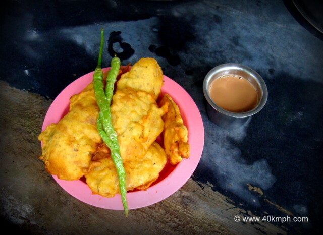
We were three and had one plate of Batata Bhaji with tea, and one Nimbu (lemon) Sharbat. The taste was awesome.
I read about Nakshatra Vedh Shala (Observatory), well written in a blog by a foreign tourist, and the day I decided to visit. I hired a Scooty from Rishikesh and reached Devprayag – 70 Km approx. distance. Once you cross…
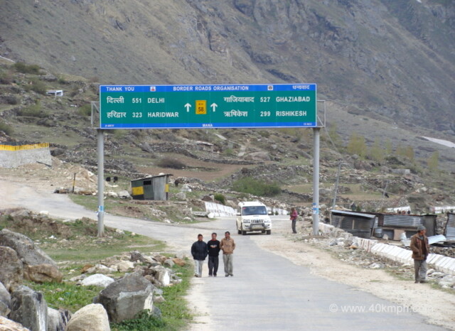
This photo was taken from Mana Village (Uttarakhand). (Distance from Badrinath in Kms) Ghaziabad – 527 Delhi – 551 Haridwar – 323 Rishikesh – 299 I have traveled within Uttarakhand via GMOU bus service but the personal choice is a…
Karanprayag to Joshimath is 80 km approx. Karanprayag > Nandprayag (20 km) Nandprayag > Chamoli (11 km) Chamoli > Peepalkoti (16 km) Peepalkoti > Garudganga (7 km) Garudganga > Joshimath (26 km)